We were actually staying on the other side of Daisetsuzan National Park, in Asahidake Onsen, which is a good 2 hour drive away from Sounkyo Onsen, the common starting point for climbing Mount Kuro (1,984m). However, the weather was quite unstable around Asahidake and we had already been drenched with rain the day before, so we decided to give it a try and drive to the other side of the mountain range. We got and early start and as if Mount Kuro had already been waiting for us, the weather got better and better the closer we came to Sounkyo Onsen, so there were no complains about the driving. In fact, we were really happy to have done it.
Mount Kuro (Kuro-dake or 黒岳 in Japanese) is quite easily accessible from Sounkyo Onsen, thanks to a ropeway and chairlift combination, which takes you up to about 1,500m above sea level. From there it takes about 1 hour, and the path is extremely well maintained and easy to follow. The views from the trail back down to Sounkyo Onsen are fantastic, but wait until you get to the top to dip into the other side.
If you’ve read any of my other articles about hiking, you probably won’t be surprised to hear that we didn’t take the ropeway or the chairlift—at least we didn’t on the way up. When we told the lady at the tourist information centre about our plan to walk up all the way, she gave us a strange look, such as “Why would you want to walk when there is a comfortable ropeway?” Understood, but we just love hiking.
The 2.5 hours indicated on the map seemed a bit exaggerated, and in fact, it took us only 1.5 hours, despite the extremely steep climb. The following trail parallel to the chairlift however, was more like walking in a streambed with large boulders, which was quite tiring to be honest. I guess we would be tempted to take the chairlift instead next time.
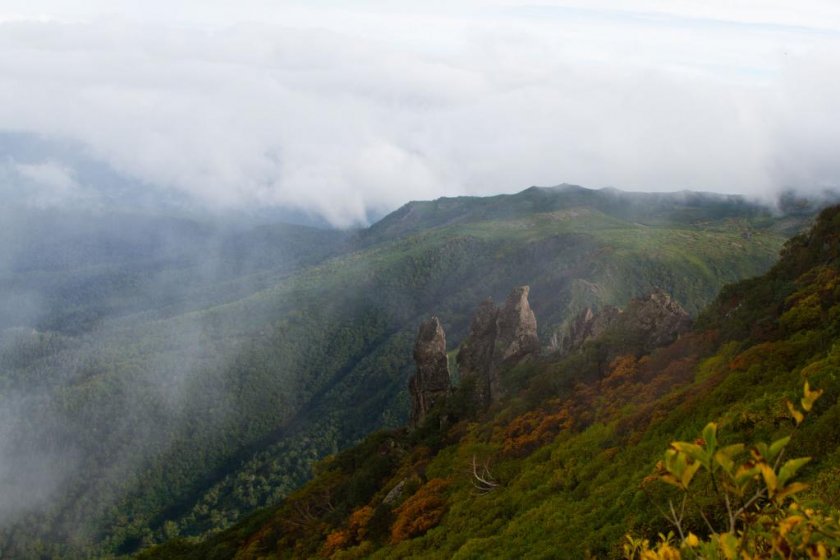
Finally, what can you expect when you are at the top? I would say a fascinating battle between mountains, clouds and colours—it’s amazing. In addition to the pictures below I created a photo story, which should give you some idea of what it’s like.
You don’t need a map for this hike. It’s all straightforward and obvious, and you will never be the only one climbing. However, if you wish to do longer day trips or even overnight trips in the area (like the famous Daisetsuzan Traverse), I recommend to buy the map "Daisetsuzan, Tokachi-dake, Poroshiri-dake (山と高原地図 3 大雪山 十勝岳・幌尻岳 2012). We bought ours at the ropeway station in Asahidake Onsen, but it's also available at amazon.co.jp as well as in larger bookstores or outdoor shops in Japan. Although the map is in Japanese only, it will still be very helpful for longer tours, as long as you get a translation for the peaks you are planning to hike. If you need any help with this, please contact me. You'll find my email address in my profile below.
If you are looking for a nice place to stay, you might be interested in the Northern Lodge Hotel.


